 A recent conversation on Clubhouse had me thinking about how I work and specifically the best way to navigate a conference. I notice there is a typical approach and those geospatial careers paths seem to be fairly beige. There doesn’t seem to be a platform for less traditional analysts to share their journey. Case in point. I was invited to speak on a popular geospatial podcast. Our preliminary interview was scheduled for 20 minutes and lasted at least an hour. I prepared, we recorded but the host decided they had no idea how to shape it into a conversation because it was not the same sort of conversation they typically record!? My time was wasted, my thoughts weren’t shared, and perhaps other women that look like me will have no idea about how anyone can begin including geospatial or geographic context in their analyses. I admit being shocked that there wasn’t a different outcome. Maybe feature the discussion as a one-off, packaged as something a little different. I don’t think it is professional to mute a voice that you find interesting but hesitate to share. Because of this, I take the time to pause and listen to all stories. Clubhouse is a great opportunity for all to join the conversations, ask questions, and share expertise. I wasn’t trained as a geologist or geographer. Granted I did attend an online executive education applied analytics program from an Ivy but whatever your foundation--you will find the right resources. I discovered spatial analytics while looking for a dynamic visualization to explore food deserts in Washington, DC. I examined the data and noticed a few pockets with hardly any grocery stores. A physical divide by a river created a physical boundary where low-income and resource challenged wards were located. I began to explore other “not so physical” barriers contributing to this insight. Working as a data analyst, the location aspect was often an afterthought--mistakingly. I participated in every MOOC by ESRI or available on Coursera with special emphasis on GIS Lounge. 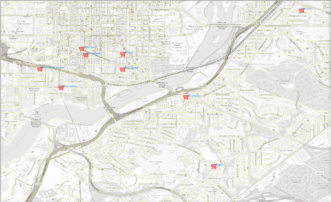 Perhaps my consultancy is successful because I understand the language necessary to make the project collaborative. Here are a few nuts and bolts:
ESRI User Conference
The important take-away is that there is not a singular way to pursue geospatial skills.
It is better to fail in originality than to succeed in imitation. Herman Melville Comments are closed.
|